Construction News
- Underwater City Planned
- MEP Awards 2014 Winners
- Building Team Awards 2015
- Aon Risk Portal
- Construction Bidding Process
- Qatar $5bn Road Projects
- Energy Efficient Glass
- Omani Water Project Tender
- Great Britain Island in Dubai
- Qatar Fifa World cup 2022
- A Socratic exercise
- Top Emporis Skyscraper
- Read More News
Estimating Tutorial
- Concrete and Masonry work
- Flooring Estimating
- Plumbing Estimating
- Paint Job Estimating
- Roof Cost Estimating
- TakeOff with Bluebeam
- Bluebeam Revu
- Formwork Material Quantity Take-off
- Install Fiber-Cement Siding
- How do you work out the construction costs
- Framing Material Takeoff
- Find More Tutorials
Road Builders found Google Earth easier to use than CAD
James Heaton is a technician in Costain Building Information Modeling (BIM). This person has invented a technique with which 3D model of A556 scheme and other geographic information system can be exported to the information which is based on Google Earth. All the people associated with project and who use Google Earth will be able to access and view this information.
Mr. James Heaton has explained his innovation that all the information including DOC boundaries and buildings which are enlisted has been published to Google Earth to make it accessible to every user. This is because most of the people do not know how to use CAD but it is easier for them to use Google Earth. It is also the matter of fact that there is different information which comes in different format from different parties, but now this information can be collected and arranged in just a single place and more data can also be added which is associated with progress of jobs. This is proved to be very helping for new users and starters. The new users just have to load Google Earth and they will be able to get knowledge about the progress of project.
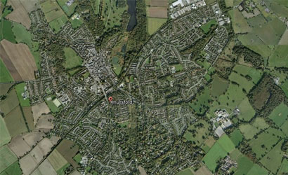
Image source: theconstructionindex.co.uk
Highway agency project was started in November 2014. This project involves construction of an entirely new section of double carriageway. The project is expected to complete complete by the fall 2016 or earlier 2017.